Flood Information
**Updated 4/17/2026*
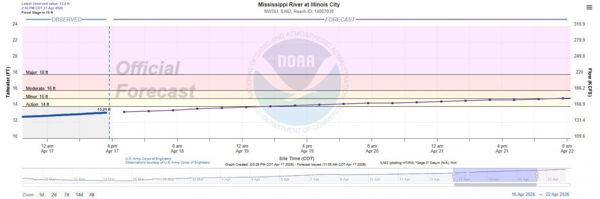
City officials are closely monitoring Mississippi River levels. The current forecast shows the river reaching 15 feet on April 22, 2026 which does not impact any areas within the City of Buffalo.
However, if the river continues to rise toward 17.5 feet, moderate flooding typically begins to affect the 1400–1500 block of Front Street (south side) and the Buffalo Shores recreation area.
For residents near the creek and storm drains, backup flooding generally begins around 19.42 feet, when water starts to seep into the streets.
The City has adequate supplies on hand and remains in monitoring mode. Updates will be provided as conditions change.
River Levels
This is a simplified guide to some of the most useful tools on the new AHPS website. Please refer to the full instruction manual here for additional details.
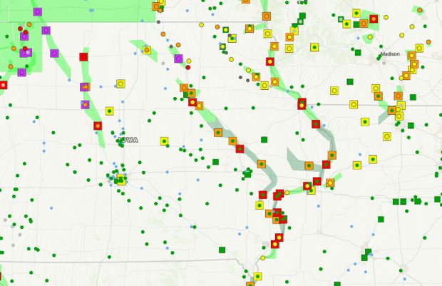
Should look like the picture to the right when you open the website.
Colored circles = current stage colored to standard flood categories
Colored squares = current 7 day forecast flood level colored to standard flood categories
Green blobs = flood watches & warnings *circle inside a square shows current and forecasted stages
FLOOD
Data
See the links below for more information.


Observed Precipitation: Northeastern Missouri, central Iowa, and central Illinois saw the highest precipitation amounts yesterday, with Missouri seeing upwards of 2.5 inches of rain, and portions of Iowa and Illinois seeing 1.5-2 inches. Central and eastern Iowa and western Illinois saw up to 1 inch of rain. There were reports of flash flooding in and around Clinton County Iowa, with some isolated locations reporting up to 5 inches of rainfall in a very short time span (observed precipitation map is attached).
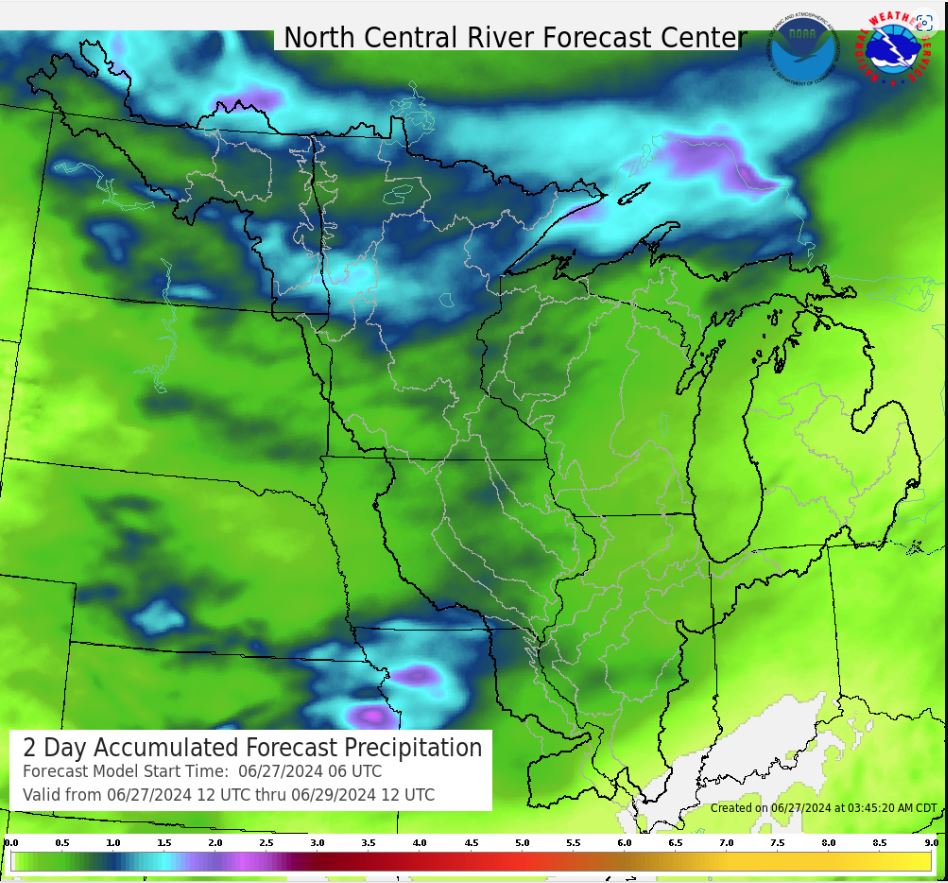
Forecast Precipitation: Dry conditions move in on Day 1, with trace amounts of precipitation possible in the southern portions of the District. Rain is possible again in central Iowa on Day 2, with the potential of up to 1.5 inches over the central and southern Des Moines River basin. Heavy rain is again possible on Day 3, with the potential for up to 2.5 inches in southeastern Iowa, northeastern Missouri, and western Illinois, and up to 1.5 inches across the remainder of the District. Light rain is possible on Days 4 and 5. Heavier rain returns to the forecast on Days 6 and 7, with the biggest treat centering over northern and central Iowa, northern Illinois, western Wisconsin, and all of Minnesota, with potentials of up to 1.5 inches.

* Day 1 – 24-hour total (rainfall included in today’s water level forecasts)
FLOOD
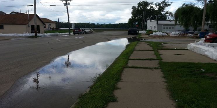
Flood Historical Pictures 2014

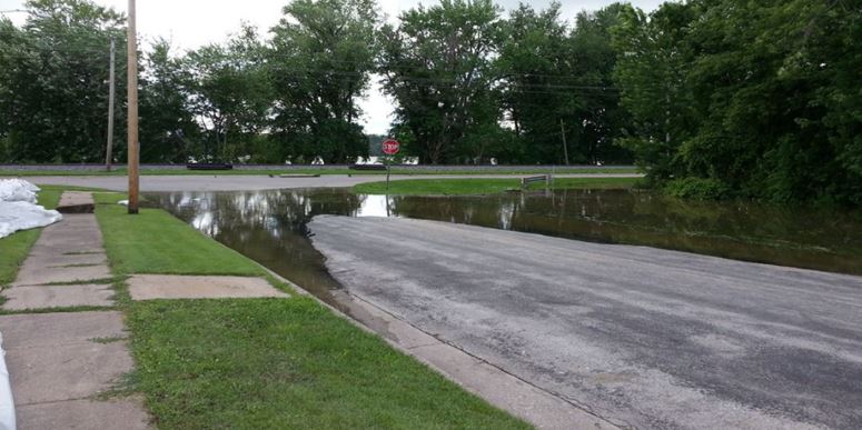
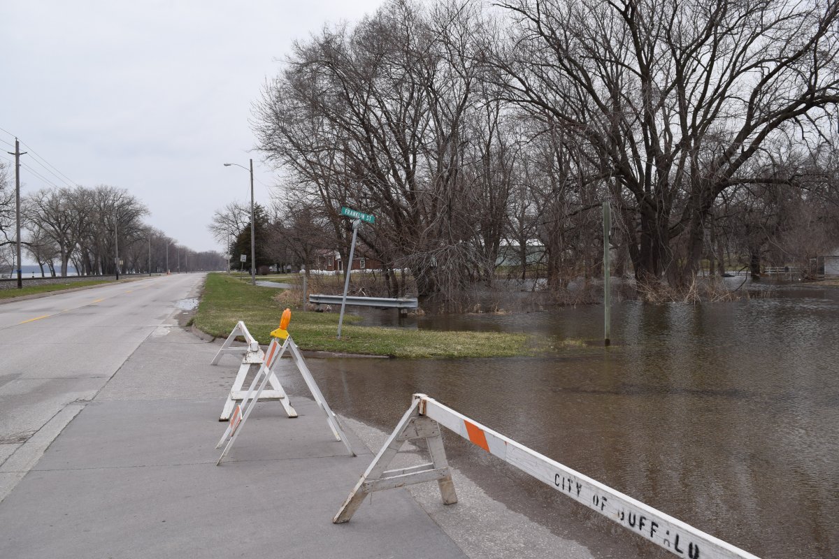
Historical Photos 2014 flood at 19.6'